Discover Attribute Labels and Drill Paths
To access the attributes in your workspace:
- Click Manage on the toolbar. The administration page opens.
- On the Data tab, click Attributes. The list of all workspace attributes opens.
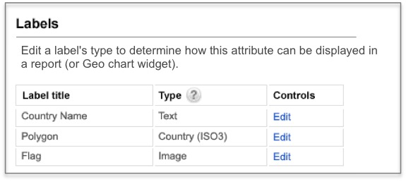
Labels
Edit a label’s type to determine how this attribute can be displayed in a report (or Geo chart widget).
Labels with the type set to one of the supported geographic regions make an attribute available for use in Geo chart widgets:
Geo pushpin
Australia States (Name)
Australia States (ISO code)
US States (Name)
US States (2-letter code)
US States (US Census ID)
US Counties (US Census ID)
World Countries (Name)
World Countries (ISO a2)
World Countries (ISO a3)
Czech Districts (Name)
Czech Districts (Name without diacritics)
Czech Districts (NUTS 4)
Czech Districts (KNOK)
Brazil States
Brazil Municipalities
Custom type options are unavailable for date attributes.
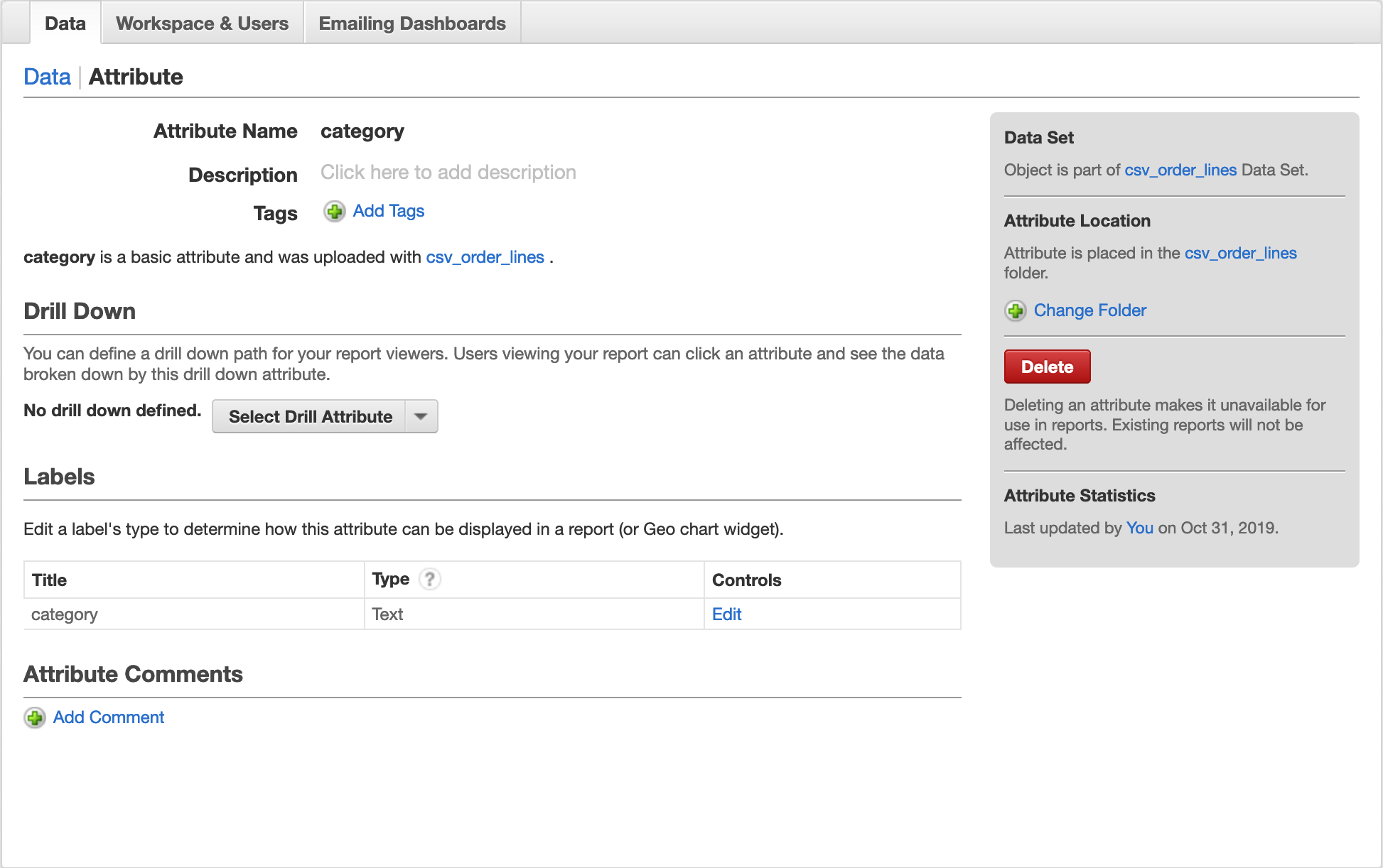
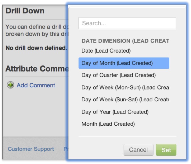
Drill Down
Note that each attribute’s detail page also provides a drill down option. Here you can set a global drill path that will be available by clicking one of the attribute’s values no matter where it appears in your workspace.
Set a drill down path by choosing an attribute of interest from the Select Drill Attribute dropdown. This is the new attribute across which a report’s metrics will be broken down.*